

22
Tour Details
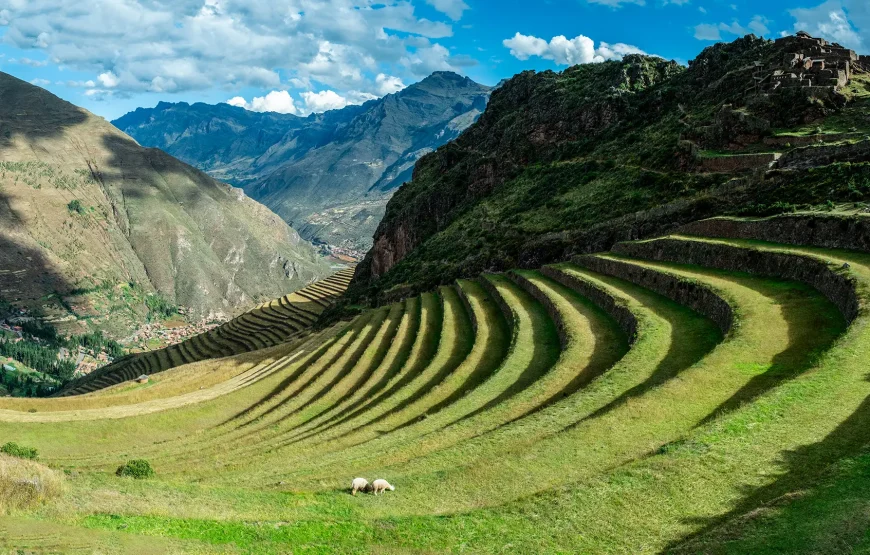
Experience one of the world’s most iconic trekking routes, following ancient stone-paved Inca roads through cloud forests, mountain passes, archaeological sites, and breathtaking Andean landscapes before arriving at the magnificent citadel of Machu Picchu through the Sun Gate.
Included / Not Included
Cost Includes
- Transfer services
- Train to Km 82
- Return train tickets
- Bus Machu Picchu - Aguas Calientes
- Inca Trail entrance permit
- Machu Picchu entrance fee
- Bilingual guide
- Breakfast (3)
- Lunch (3)
- Dinner (3)
- Camping equipment
Cost Does Not Include
- Sleeping bag
- Energy bars and snacks
- Hot springs entrance fee in Aguas Calientes
- Huayna Picchu entrance fee
- Walking sticks
- Personal porter
- Tips
Trip Information
Season
Available throughout the year except February
Destination
Cusco - Inca Trail - Machu Picchu
Experience
Multi-Day Trekking and Archaeology
Difficulty
Moderate to Challenging
Itinerary
Expand All
Cusco - Huayllabamba
Early pick-up between 5:50 and 6:30 a.m. for the drive to Km 82, the start of the Inca Trail. We travel through the Sacred Valley, passing Chinchero, Urubamba, and Ollantaytambo, where there is time for breakfast and last-minute purchases such as water, walking sticks, rain ponchos, and snacks. At Km 82 (2,850 m), we meet the crew, cross the Urubamba River after the checkpoint, and begin hiking toward Miskay. The trail then turns west to the Huillcaraccay Inca site and continues along the Kusichaca Valley to Huayllabamba (3,000 m). Dinner and overnight in tents. (L, D)
Trail Information
Maximum altitude: 3,000 m / 10,824 ft. Minimum altitude: 2,680 m / 8,790 ft. Distance: 12 km / 7.47 miles Walking time: 6–7 hours / Ascent: 3,000 m (9,840 ft.)
Huayllabamba - Pacaymayo
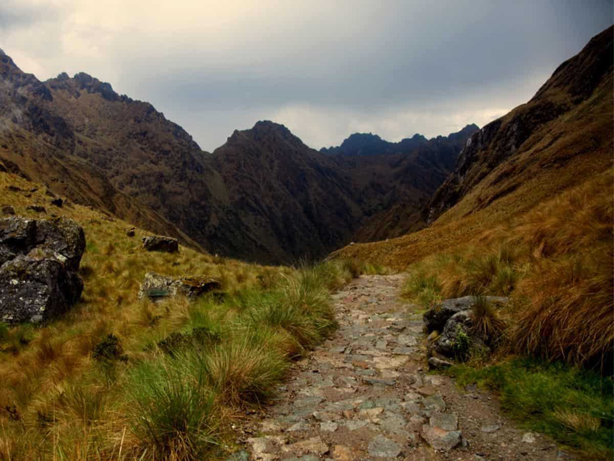
This is the toughest day of the trek, as we cross Warmihuañusca Pass (4,200 m), or Dead Woman’s Pass. We leave Huayllabamba early, climb through cloud forest to Llulluchapampa (3,850 m) for views of the valley below, then continue to the pass. After crossing it, we descend steeply to our campsite in the Pacaymayo Valley (3,600 m). (B, L, D)
Trail Information
Maximum altitude: 4,200 m / 13,776 ft. Minimum altitude: 3,000 m / 9,840 ft. Distance: 11 km Walking time: 7–8 hours / Ascent: 4,200 m (13,776 ft.)
Pacaymayo - Wiñayhuayna
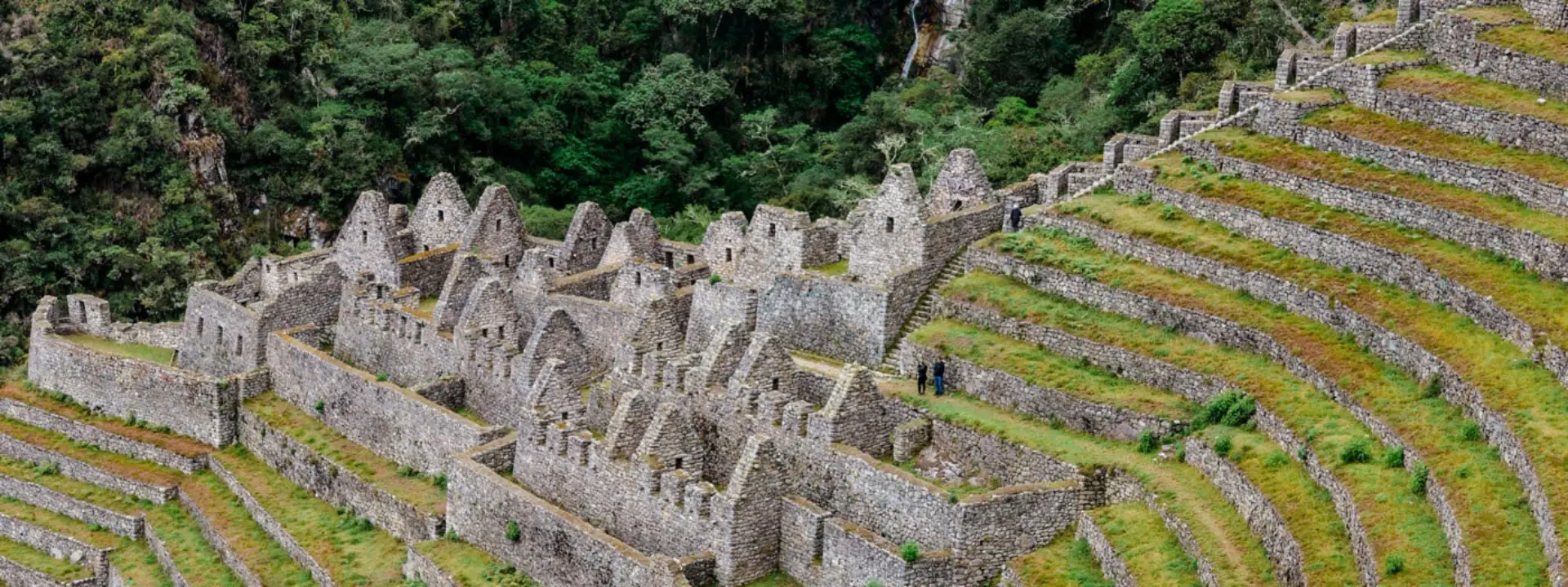
Today we follow one of the finest stretches of the Inca Trail. After a short rest at Runcuraccay (3,700 m), a small Inca lookout in the cloud forest, we continue through well-preserved elfin and cloud forest crowned by distant sacred snow peaks reaching more than 5,500 m. Thereafter we arrive to Sayacmarca (3,600 m) and then continue to the west heights of the Urubamba Canyon, until Phuyupatamarca (3,650 m), another Inca site also built in the clouds. The trail changes into a steep descend towards a dense more developed cloud forest and the beautiful citadel of Wiñayhuayna (2,550 m), this spot offers superb views of the Urubamba Canyon. Camping. (B, L, D)
Trail Information
Maximum altitude: 3,750 m / 12,300 ft. Minimum altitude: 2,700 m / 8,856 ft. Distance: 16 km / 9.94 miles Walking time: 7–8 hours / Descent: 700 m
Wiñayhuayna - Machu Picchu
We rise at 4:00 a.m. and leave camp an hour later to hike about one hour to Inti Punku, or the Sun Gate, along a stone trail with dramatic views. From this superb viewpoint, we watch sunrise over Machu Picchu. We then descend for about 40 minutes to enter the citadel near the Guardian’s House, continue to the checkpoint to register and leave our backpacks, and begin a guided tour of about two hours. There is then free time to explore the site or climb Huayna Picchu if booked in advance. Other options include the Temple of the Moon or the Inca Bridge.
Return to Cusco
Later, we take the bus to Aguas Calientes for lunch and return by train and bus to Cusco, arriving around 20:00. Transfer to the hotel. (B)
Trail Information
Maximum altitude: 2,700 m / 8,856 ft. Minimum altitude: 2,400 m / 7,872 ft. (Machu Picchu) Distance: about 8 km, plus time exploring Machu Picchu Walking time: 2–3 hours / Descent: 300 m
Frequently Asked Questions
Expand All
No. The Inca Trail is closed during February each year for maintenance.
The highest point is Warmihuañusca Pass (Dead Woman's Pass) at 4,200 meters above sea level.
No. Sleeping bags must be rented separately or brought by participants.
Location
Related tours

Cusco-Sacred Valley-Machu Picchu-Cusco (EA12)
Cusco – Sacred Valley – Ollantaytambo – Machu Picchu
4 Days / 3 Nights
Cusco, Sacred Valley, Inca Trail and Machu Picchu Maras and Moray (EA14)
Cusco – Sacred Valley – Inca Trail – Machu Picchu – Maras – Moray
6 Days / 5 Nights
Cusco-Valle Sagrado-Aguas Calientes-Machu Picchu-Cusco (EA16)
Cusco – Sacred Valley – Aguas Calientes – Machu Picchu
4 Days / 3 Nights